Share Following the July response confirming Engineering's transportation review "may include development conditions... to improve transportation operations and safety," can the City confirm specifically whether emergency vehicle access and response times at Union/Raymur have been assessed for this application — given the site's location beside an active rail crossing, and given a recently established ambulance facility operating nearby? As a neighbour who walks this corridor daily, I've observed regular ambulance activity near the site. Has this been factored into the transportation and emergency access review? Separately, given the new St. Paul's Hospital campus opening nearby on the False Creek Flats, and unresolved viaduct-related road network changes in the area, has the application's traffic analysis accounted for these cumulative, changing neighbourhood conditions in addition to this project's own construction-phase impacts? on Facebook
Share Following the July response confirming Engineering's transportation review "may include development conditions... to improve transportation operations and safety," can the City confirm specifically whether emergency vehicle access and response times at Union/Raymur have been assessed for this application — given the site's location beside an active rail crossing, and given a recently established ambulance facility operating nearby? As a neighbour who walks this corridor daily, I've observed regular ambulance activity near the site. Has this been factored into the transportation and emergency access review? Separately, given the new St. Paul's Hospital campus opening nearby on the False Creek Flats, and unresolved viaduct-related road network changes in the area, has the application's traffic analysis accounted for these cumulative, changing neighbourhood conditions in addition to this project's own construction-phase impacts? on X (formerly Twitter)
Share Following the July response confirming Engineering's transportation review "may include development conditions... to improve transportation operations and safety," can the City confirm specifically whether emergency vehicle access and response times at Union/Raymur have been assessed for this application — given the site's location beside an active rail crossing, and given a recently established ambulance facility operating nearby? As a neighbour who walks this corridor daily, I've observed regular ambulance activity near the site. Has this been factored into the transportation and emergency access review? Separately, given the new St. Paul's Hospital campus opening nearby on the False Creek Flats, and unresolved viaduct-related road network changes in the area, has the application's traffic analysis accounted for these cumulative, changing neighbourhood conditions in addition to this project's own construction-phase impacts? on Linkedin
Email Following the July response confirming Engineering's transportation review "may include development conditions... to improve transportation operations and safety," can the City confirm specifically whether emergency vehicle access and response times at Union/Raymur have been assessed for this application — given the site's location beside an active rail crossing, and given a recently established ambulance facility operating nearby? As a neighbour who walks this corridor daily, I've observed regular ambulance activity near the site. Has this been factored into the transportation and emergency access review? Separately, given the new St. Paul's Hospital campus opening nearby on the False Creek Flats, and unresolved viaduct-related road network changes in the area, has the application's traffic analysis accounted for these cumulative, changing neighbourhood conditions in addition to this project's own construction-phase impacts? link
Following the July response confirming Engineering's transportation review "may include development conditions... to improve transportation operations and safety," can the City confirm specifically whether emergency vehicle access and response times at Union/Raymur have been assessed for this application — given the site's location beside an active rail crossing, and given a recently established ambulance facility operating nearby? As a neighbour who walks this corridor daily, I've observed regular ambulance activity near the site. Has this been factored into the transportation and emergency access review? Separately, given the new St. Paul's Hospital campus opening nearby on the False Creek Flats, and unresolved viaduct-related road network changes in the area, has the application's traffic analysis accounted for these cumulative, changing neighbourhood conditions in addition to this project's own construction-phase impacts?
concernedneighbours
asked
about 1 month ago
The City’s transportation strategy for the False Creek Flats and Downtown Eastside area includes improvements for all modes, including network enhancements and intersection changes, and staff continue to work on improving facilities for people walking, cycling, taking transit, and driving. The False Creek Flats Area Plan and Downtown Eastside Plan identify several traffic-related and other transportation interventions, such as new signals and pedestrian, cycling and transit improvements and these will continue to be delivered as development continues in these areas.
Emergency access is regulated through the BC Building Code, Vancouver Building By-Law, and the Vancouver Fire By-Law. Emergency vehicle access reviews are carried out by Vancouver Fire and Rescue Services (VFRS) during the development and building permit application stages of a project. Compliance with emergency requirements is reviewed by Vancouver Fire Rescue Services, which evaluates fire department access routes, emergency vehicle maneuvering, access to fire protection systems, and construction-phase emergency access arrangements as part of the City's permit review process. Emergency vehicles choose the safest and most direct route available to a site. Similarly, to any other street in the city, emergency vehicles will safely cross into oncoming traffic if they encounter congestion. This is normal practice for emergency vehicles.
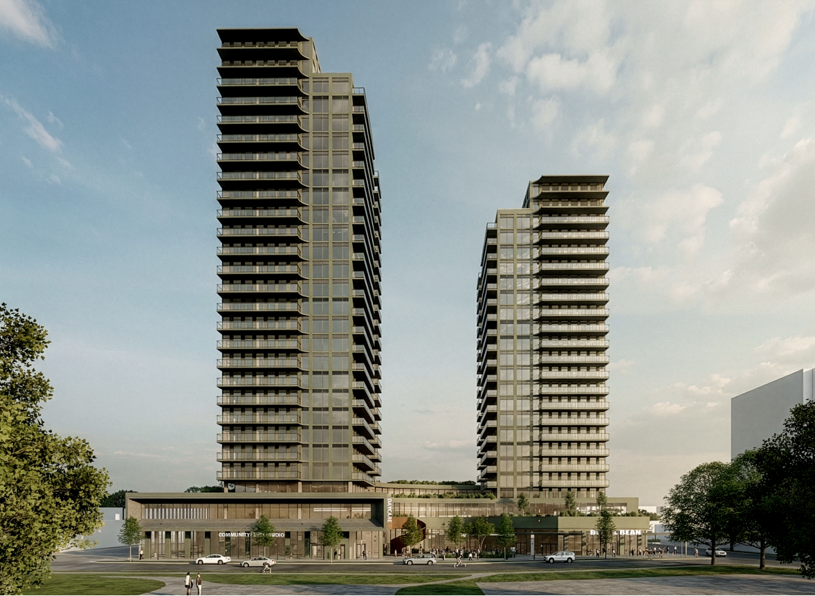
Share This proposal would introduce 436 rental units, ground-floor commercial space, and a childcare facility to an area with a limited road network. What analysis has been completed to demonstrate that the surrounding transportation infrastructure can accommodate the additional traffic, and what specific improvements or mitigation measures are proposed to prevent increased congestion and impacts to emergency vehicle access? on Facebook
Share This proposal would introduce 436 rental units, ground-floor commercial space, and a childcare facility to an area with a limited road network. What analysis has been completed to demonstrate that the surrounding transportation infrastructure can accommodate the additional traffic, and what specific improvements or mitigation measures are proposed to prevent increased congestion and impacts to emergency vehicle access? on X (formerly Twitter)
Share This proposal would introduce 436 rental units, ground-floor commercial space, and a childcare facility to an area with a limited road network. What analysis has been completed to demonstrate that the surrounding transportation infrastructure can accommodate the additional traffic, and what specific improvements or mitigation measures are proposed to prevent increased congestion and impacts to emergency vehicle access? on Linkedin
Email This proposal would introduce 436 rental units, ground-floor commercial space, and a childcare facility to an area with a limited road network. What analysis has been completed to demonstrate that the surrounding transportation infrastructure can accommodate the additional traffic, and what specific improvements or mitigation measures are proposed to prevent increased congestion and impacts to emergency vehicle access? link
This proposal would introduce 436 rental units, ground-floor commercial space, and a childcare facility to an area with a limited road network. What analysis has been completed to demonstrate that the surrounding transportation infrastructure can accommodate the additional traffic, and what specific improvements or mitigation measures are proposed to prevent increased congestion and impacts to emergency vehicle access?
AD123
asked
about 2 months ago
Transportation safety for motorists, cyclists, and pedestrians, is a top priority for the City of Vancouver. The proposed development is required to comply with the Parking By-law with respect to off-street vehicle parking spaces (no minimums) and well-sited to encourage reduced vehicle trip and parking demand. It is in close proximity to the frequent transit network (Clark Dr), cycling infrastructure (existing bikeways along Union St). As part of the rezoning process, Engineering staff include a review of the application with respect to transportation impacts and, if identified, may include development conditions for off-site requirements to improve transportation operations and safety for pedestrians, cyclists, and motorists adjacent to the site.