Images

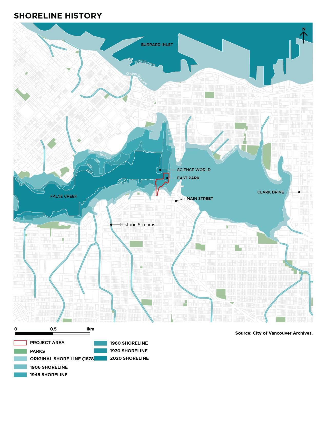
This graphic is based on the floodplain map in the City of Vancouver document ‘Vancouver’s Changing Shoreline,’ available online. Without flood management measures in place, areas in dark blue are vulnerable to flooding due to a major storm (1:500 year storm) today and areas in light blue are vulnerable to flooding due to a major storm and 1 metre of sea level rise by 2100.
A floodplain is a lowland area that is susceptible to flooding from an adjoining watercourse, ocean, lake or other body of water. Note: flood extents are based on major flood event (i.e., 1:500 year storm event and 1 metre of sea level rise by 2100).