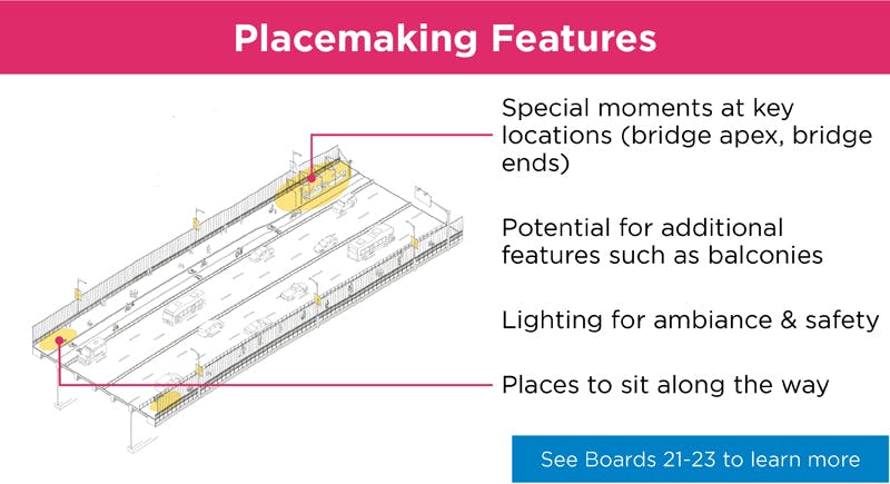
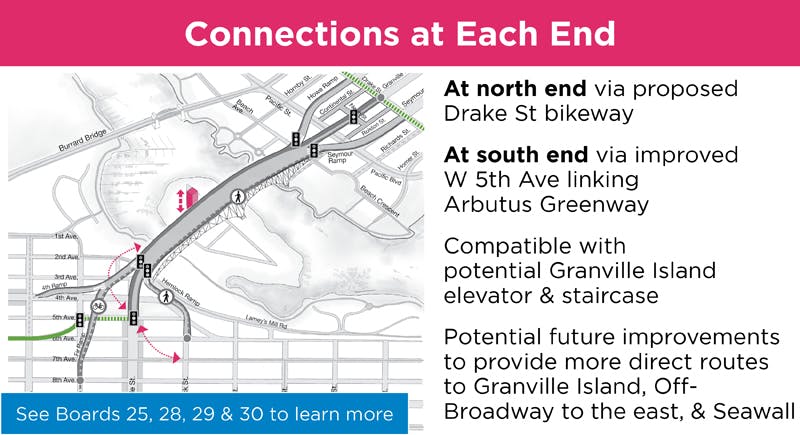
• Skip to main content
  • Jump to navigation
  • Search
Globe

IE10 and below are not supported.

Google Chrome Mozilla Firefox

Contact us for any help on browser support

Shape Your City Vancouver
Shape Your City

You are here:

  • Home
  • Public engagement projects
  • Granville Connector

Photos

West Side Primary Path
previous next
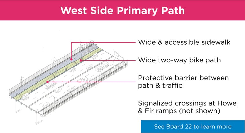
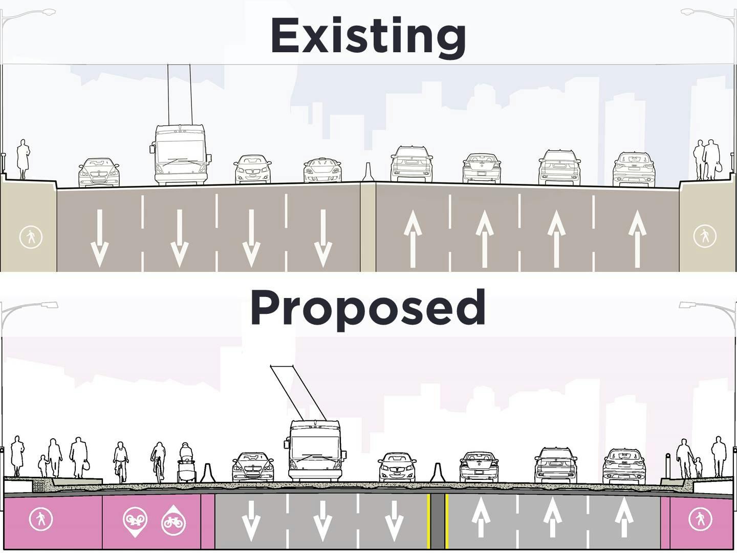
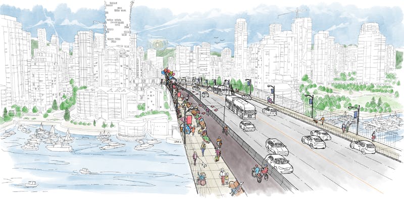
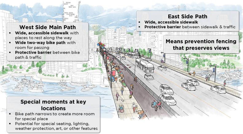
The proposed primary path on the west side of the bridge includes: 
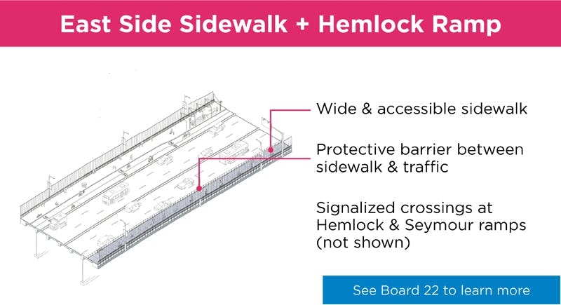
(1) a wide and accessible sidewalk (typical 4.2m), with room for furniture along the way; 
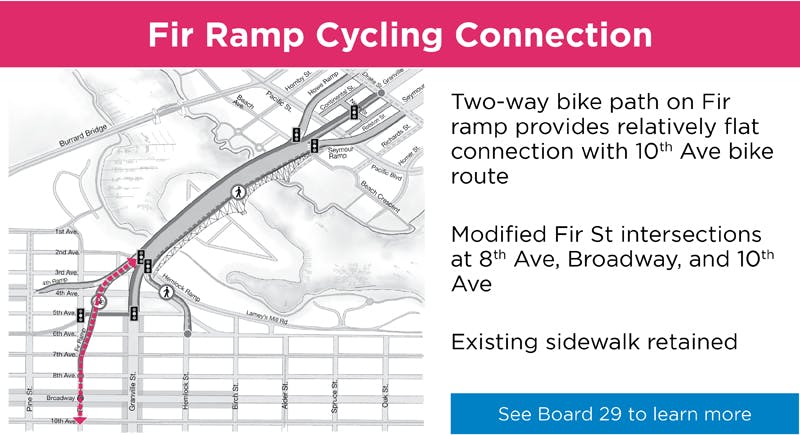
(2) a wide two-way bike path (typical 4.2m) between the sidewalk and traffic lanes, with room for passing in each direction; (3) a protective barrier between the bike path and motor vehicle lane; and 
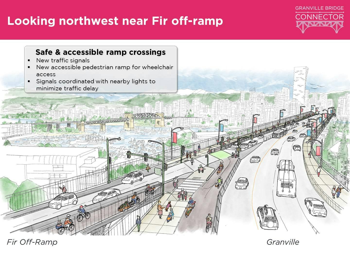
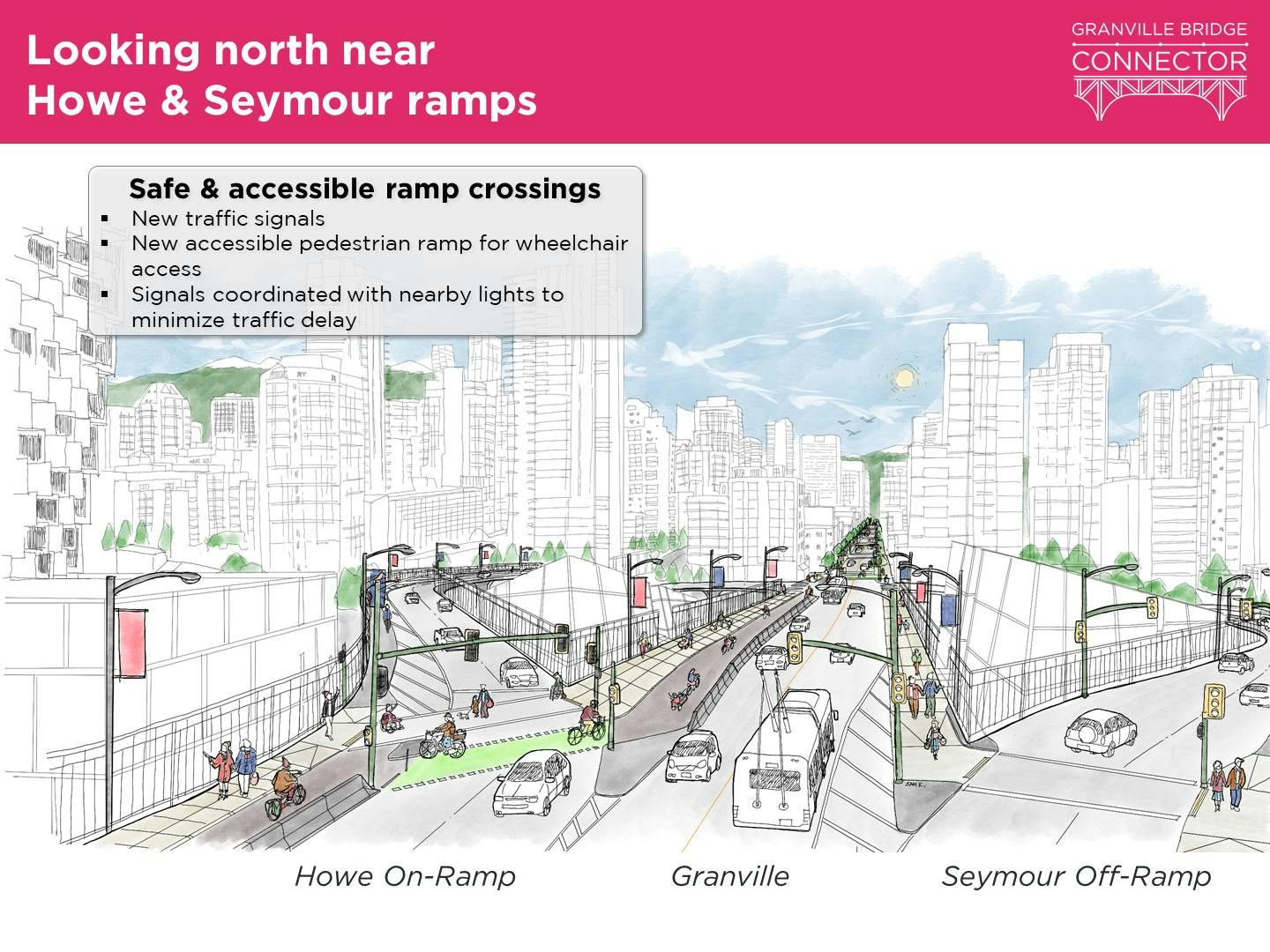
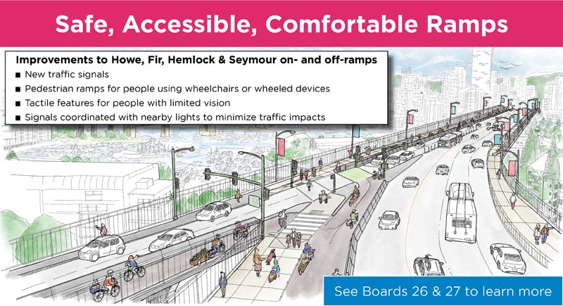
(4) redesigned intersections with signals at the Howe and Fir ramps, to make them safe, accessible, and comfortable to cross.
Overview Map
Typical cross-sections
Artists rendition of the Granville Bridge Mid span looking North
Artists rendition of the Granville Bridge looking northwest near Fir off-ramp
Artists rendition of the Granville Bridge looking north near Howe & Seymour ramps
West Side Primary Path
East Side & Hemlock Ramp - Sidewalk Improvements
Means Prevention Fencing
Fir Ramp Cycling Connection
Urban Design and Special Places
New Ramp Crossings
Bridge Ends and Connections
Introduction.jpg
Overall Opinion.jpg

© 2020 City of Vancouver

  • Terms of Use
  • Privacy Policy
  • Accessibility
  • Technical Support
  • Sitemap
  • Moderation
  • powered by EngagementHQ